Thanks to Google’s partnerships with a variety of global organizations, you’re now able to take tours of a remote area in northern Manitoba, a nature reserve in California and an Amazonian rainforest.
From polar bears in the Canadian Arctic, to communities in the Brazilian Amazon, to blue oak trees in Central California, the impacts of climate change is being felt by plants, animals and people across the planet. As world leaders gather for the COP21 conference in Paris this week to discuss our changing climate, we want to take this opportunity to show you how to explore its impact yourself. With Street View, you can get a window into some of our world’s changing ecosystems, and learn how nonprofit and other organizations are working to keep our planet healthy.
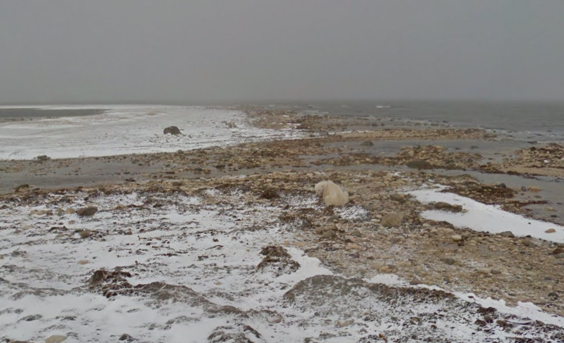
Conservation group Polar Bears international used Google’s 360 degree Trekker camera to monitor the amount of ice present in the Churchill, Manitoba area. The project’s first image shows a dejected looking polar bear standing on the shore of Hudson’s Bay where large sheets of ice were once present.
The initiative also highlights central California, an area where the region’s population of blue oak trees is diminishing due to climate change, and the Brazilian Amazon rainforest.
In the past Google Earth Outreach has worked with the Environmental Defense Fund and Aclima to track methane leaks in the United States with the help of the Google’s camera equipped Street View vehicles. The project has also taken a camel trip across the Arabian desert and even a trek underwater.
COP21, The UN’s climate change talk in Paris, recently kicked off.
[source]9to5 Google[/source]
MobileSyrup may earn a commission from purchases made via our links, which helps fund the journalism we provide free on our website. These links do not influence our editorial content. Support us here.


