Google announced several features coming to Google Maps over the next few days that will help people get around during the COVID-19 pandemic.
According to a blog post from the company, users will soon be able to get alerts about important COVID-related information in Google Maps. For example, drivers can get alerts about COVID-19 checkpoints and restrictions along their route, such as when crossing national borders. Google says this will start in Canada, Mexico and the U.S. first.
Additionally, Argentina, Australia, Belgium, Brazil, Colombia, France, India, Mexico, Netherlands, Spain, Thailand, the U.K. and the U.S. will get public transit alerts too. These alerts will inform users about relevant information from transit agencies, such as the need to wear a mask or changes to bus routes.
The blog also notes that Maps will remind users to verify eligibility and facility guidelines to avoid people from getting turned away when they navigate to a medical facility or COVID-19 testing center. This feature will be available in Indonesia, Israel, the Philippines, South Korea, and the U.S. Testing center alerts will be available in the U.S.
Google says it shows alerts when it receives “authoritative data from local, state and federal governments” and that it’s actively working with other agencies globally to bring more helpful data to Maps users.
Helping public transit users avoid crowds

Google Maps has offered ‘crowdedness predictions’ for public transit since last year. The feature is powered by “tens of millions of contributions,” according to Google, which can help people see how crowded certain buses, trains and other transit options tend to be.
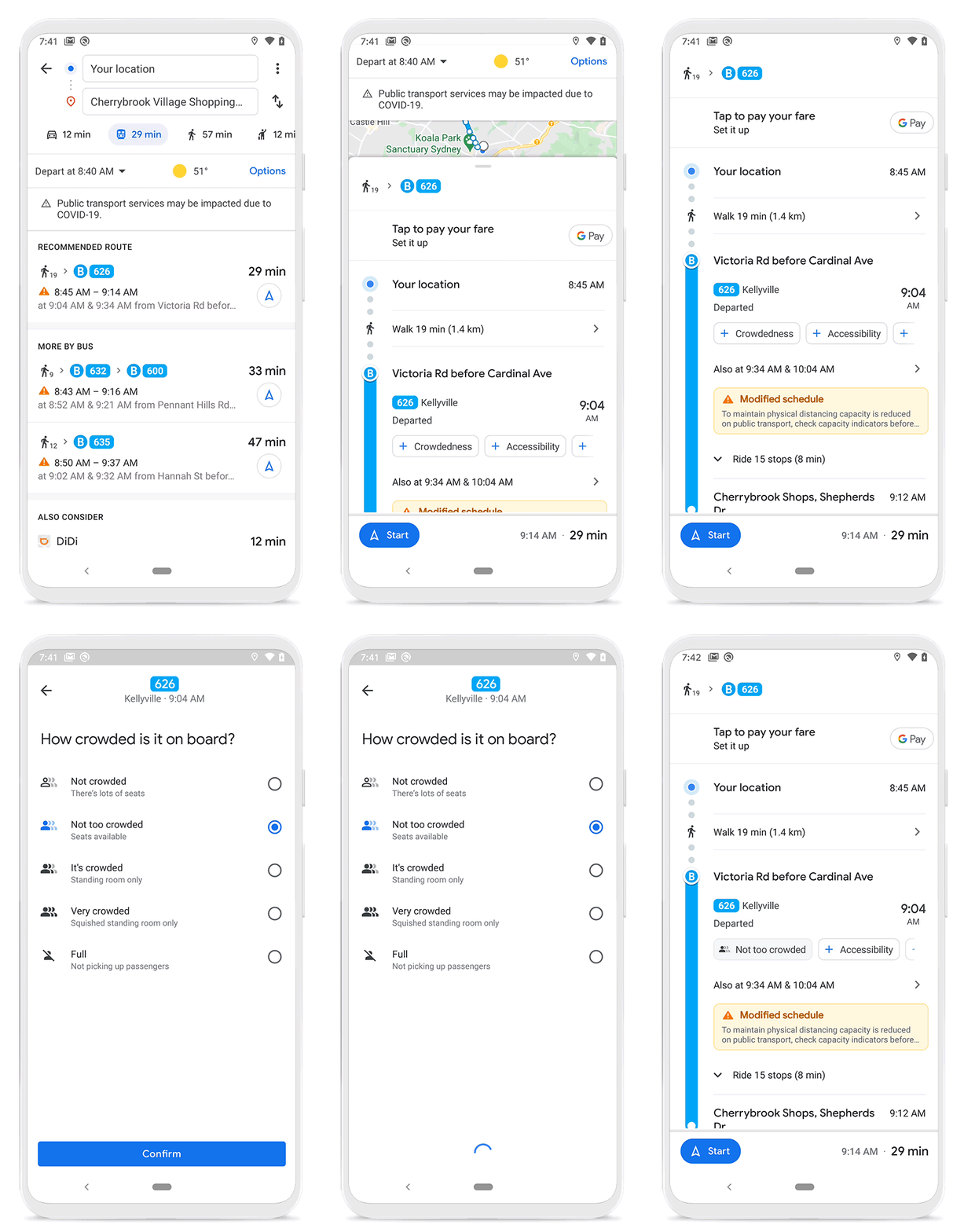
Now, Google says it’s making it easier for people to contribute crowdedness information for their transit lines. To do so, users can tap the ‘Crowdedness’ button when looking at a transit route to submit details about how many people there are.
Additionally, Google says it added more granular accessibility information for people to contribute, such as where there are wheelchair-accessible doors, seating, stop buttons and more.

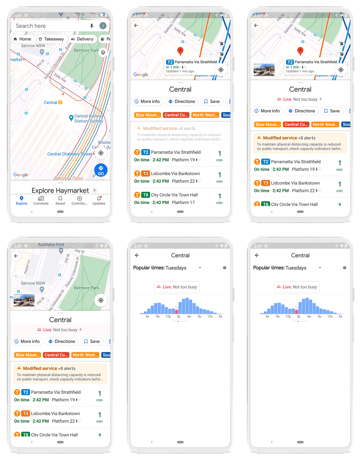
Starting June 8th, Google says Maps will be able to show which times a transit station is usually most busy, as well as how busy it is at the current moment.
Google says that all these new features are powered by aggregates and anonymized data from users who have opted in to Google Location History. Location History is a Google account-level setting that is off by default.
You can learn more about all the new features on Google’s blog.
MobileSyrup may earn a commission from purchases made via our links, which helps fund the journalism we provide free on our website. These links do not influence our editorial content. Support us here.


