
The City of Toronto has released StreetARToronto, a web-map that shows off where the city’s many outdoor art projects are located.
The virtual map displays a massive amount of blue dots in Toronto and the surrounding area. Each dot represents a mural or art project.
Users can filter the dots by year and ward to dial back the number displayed. For example, you could filter the web app to only look at art from 2012 located in the city centre.
The art the map includes is part of the city’s StreetARToronto suite of programs. The website’s welcome page says that it only consists of a sampling of the program’s art.
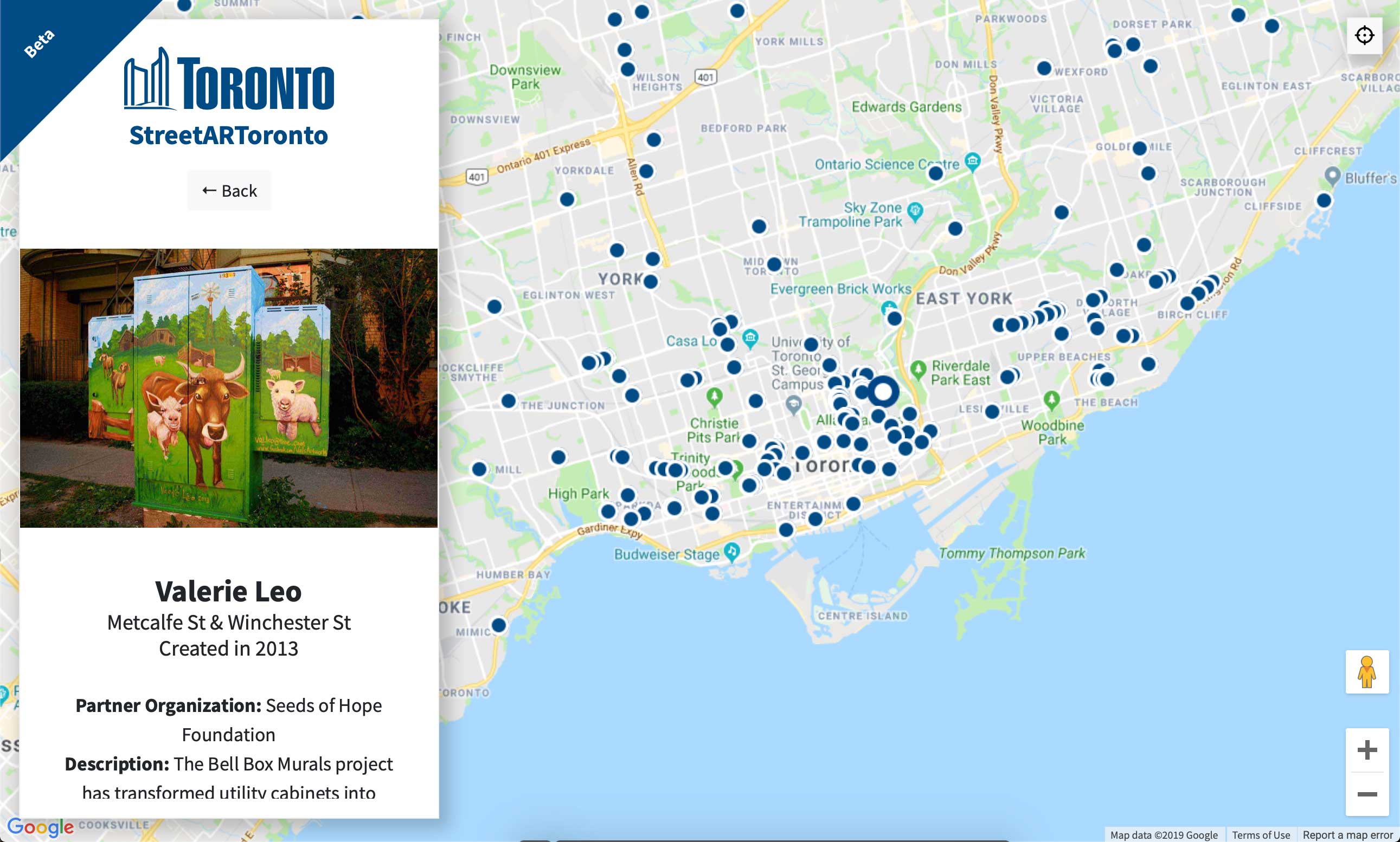
When you click on a blue dot, it opens up a page about the art. There’s also a description of the piece along with the name of the partner organization who helped make it.
The site is still in beta, but it seems to run pretty well in my experience. The map utilizes Google Maps’ platform, so you can even look at the art with street view.
Source: The City of Toronto
MobileSyrup may earn a commission from purchases made via our links, which helps fund the journalism we provide free on our website. These links do not influence our editorial content. Support us here.
