
If you live in Toronto, you’ve probably already encountered issues safely navigating the city’s sidewalks while maintaining the two-metre physical distancing guideline.
Toronto implemented two programs to help with this: #CurbTO, which will free up some curb lane space at 100 locations with known lineups like grocery stores and #ActiveTO, which plans to implement 50km of ‘quiet’ streets. While the change is definitely progress, it can still leave some areas difficult to navigate.
However, a Toronto-made navigation app is hoping to help by providing a physical distancing mode that will route directions through less crowded areas.
MapinHood, developed by Toronto-based startup iMerciv with support from the Microsoft AI for Accessibility program, now offers the new navigation mode for pedestrians. In fact, MapinHood’s whole ethos is about pedestrians. iMerciv positions the app as a navigation system for people, not cars, and built MapinHood with several unique navigation criteria that users can pick from.
For example, MapinHood can help construct walking routes that avoid dark streets, steep slopes, stairs or other obstacles.
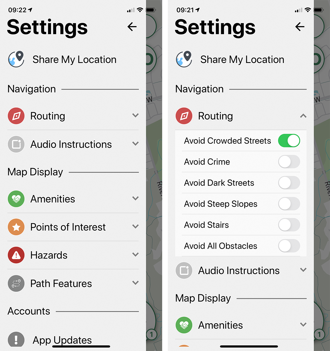
As of May 11th, the app now includes an ‘Avoid Crowded Streets’ option under the ‘Routing’ tab in the Settings menu. When users enable it, MapinHood will provide walking directions that avoid crowded areas using data based on historic pedestrian foot traffic data. For example, that could mean MapinHood will take you along less busy streets and avoid main streets.
Further, MapinHood is working on a ‘Round Trip’ feature. It allows users to set a timed route that will start and end at their home while avoiding “unnecessary risks” while outside. Finally, the MapinHood team plans to launch a ‘LineUp’ feature that can estimate the wait times at essential locations like grocery stores, pharmacies and restaurants. Users will also be able to report if there a line at their destination and the estimated wait times so that other MapinHood users can view that data.
Those interested in learning more about MapinHood’s social distancing feature can check out this blog post. You can also learn more about MapinHood on the app’s website.
MobileSyrup may earn a commission from purchases made via our links, which helps fund the journalism we provide free on our website. These links do not influence our editorial content. Support us here.
